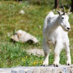
Strike a Pose: Glacier National Park, August 2006 At Logan Pass, we watched several mountain goats. This one was particularly brave, as he walked along a wall near the parking lot. (via Robby Edwards’ Photos)
Strike a Pose: Glacier National Park, August 2006 At Logan Pass, we watched several mountain goats. This one was particularly brave, as he walked along a wall near the parking lot. (via Robby Edwards’ Photos)
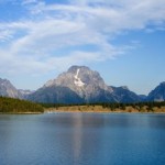
Mt. Moran Panorama: Grand Teton National Park, August 2006 (via Robby Edwards’ Photos)
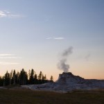
Castle Geyser Sunset: Yellowstone National Park, July 2006 Steam rises from Castle Geyser as the as the sun sets on the horizon. (via Robby Edwards’ Photos)
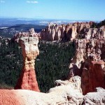
Along the Edge: Bryce Canyon National Park, September 2001 Just barely visible in the distance is Navajo Mountain which is about 90 miles away. Bryce Canyon lies along the edge of the Paunsaugunt Plateau, which forms the western, higher part of the park. The plateau falls away into the Paria Valley, which lies between the Paunsaugunt and Aquarius Plateaus. At one time these two plateaus were joined together, but time and geologic forces have eroded the land away, creating the beautiful rock formations found at Bryce. (via Robby Edwards’ Photos)
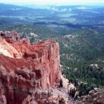
The Paria Valley Below: Bryce Canyon National Park, September 2001 Bryce Canyon lies along the edge of the Paunsaugunt Plateau, which forms the western, higher part of the park. The plateau falls away into the Paria Valley, which lies between the Paunsaugunt and Aquarius Plateaus. At one time these two plateaus were joined together, but time and geologic forces have eroded the land away, creating the beautiful rock formations found at Bryce. (via Robby Edwards’ Photos)
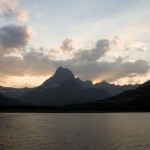
At the End of the Day: Glacier National Park, August 2006 Another shot of the lovely sunset taken from behind the Many Glacier Lodge. (via Robby Edwards’ Photos)
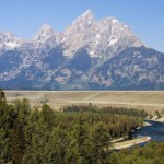
Snake River: Grand Teton National Park, August 2006 I returned to the Snake River Overlook, once the fog had cleared, to get a more traditional photo of the Snake River and the Cathedral Group. (via Robby Edwards’ Photos)
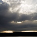
And the Light Shines Through: Yellowstone National Park, July 2006 (via Robby Edwards’ Photos)